Fixing the Master Plan Data Model

Tampere began improving the master plan data model as a KIRA-digi trial project in November 2017. The project was chosen as one of the best projects of the funding round and advances the Finnish goverment’s key project to advance the digitalization of public services.
The goal of the project is to produce a national data model. For this reason, co-operating with zoning planners from other cities is of primary importance. The master plan data model is related to the overall process of land use and the development of its enterprise resource planning. In Tampere, the goal is to develop the overall land use process by achieving consistent and fluent data exchange. The new data model also acknowledges international requirements, such as the EU INSPIRE directive.
“We see no reason why this data model couldn’t be an ‘export product’, or even why it couldn’t be used to improve the INSPIRE data model.
When possible, the data model is developed so that it can be used to present data produced in a foreign land use planning system. The results of the project will be published on GitHub and may be freely viewed and utilized over country borders. We see no reason why this data model couldn’t be an ‘export product’, or even why it couldn’t be used to improve the INSPIRE data model”, tells Jarno Kinnunen, leading Senior Planning Officer at the City of Tampere.
In Finland, similar work has also been done on other levels of zoning. Helsinki has an ongoing city plan data model project and the HAME project has developed a data model for regional plans. Meanwhile, the Finnish Ministry of Environment is focusing on national digitalization measures and solutions, making Tampere’s project rather timely. Minna Perähuhta, a specialist of the Ministry of Environment, stated the following on 14.12.2017, in the annual meeting of the Finnish Geospatial Data Network:
– We didn’t think the KIRA-digi project ensemble would include such harmonisation experiments. Helsinki’s city plan data model project surprised us first. The original idea was to collaboratively harmonise projects within the KIRA-digi ensemble. Having harmonisation efforts at such an early stage was a pleasant surprise. We then had the harmonisation of the zoning plan data model project, which was an even more structured entirety.”
With these projects, it’s a good time to look forward to an open harmonised data model and tighter collaboration with other projects.

WHAT’S BEING DONE?
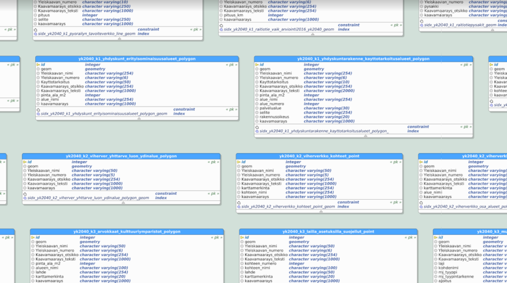
In addition to creating an open data model, the goal of the project is to develop a continuous process for master planning, create a standard for master planning data contents, and provide input for the upcoming land use law update. The data model is developed so that interested parties may adapt the data model as easily as possible. Primary needs are related to streamlining the technical implementation of the master plan and fully taking advantage of technical possibilities. Currently, a lot of overlapping work is being done, and processes which could be automated are performed manually. The secondary goal of the project is to improve the efficiency of the overall land use process.
– Additionally, it’s possible to set an example to improve the efficiency of the overall land use process by “stepping out of the box” and extracting valuable information from the data through the data model, says Jarno Kinnunen.
Through the data model and its development, land use decisions can be made available in a machine readable format. Once these decisions are in a standardised format, they can be easily shared using international geospatial data interfaces and used to develop various services that provide additional value. Other benefits include increased transparency of the general plan design process, improved efficiency of the design process, and improvements in the quality and availability of data produced by the design process. The City of Tampere describes the process:
– In the 2000s, Tampere has focused on creating approx. 20 partial general plans. Developments have been made in the presentation and content of the general plan, and the potential of geographic information system software has been realized. Massive leaps have been made, and the data required to produce the general plan is approaching a situation where the data, which is mostly produced outside our own unit, is up-to-date and of sufficient quality to be linked directly to the object in the general plan. In other words, organisational and technical developments have made the data models possible.
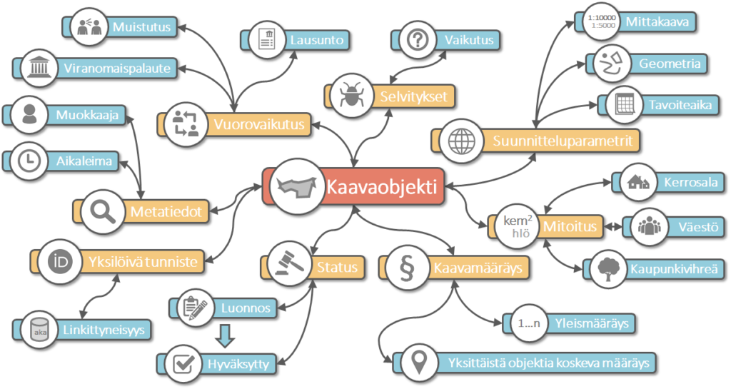
Meanwhile, work is underway to determine how data that is essential to the general plan can be linked to e.g. the city plan, and how this information can be managed. The idea is to use each object from the master plan, such as a residential or recreational zone, as a platform, that can be appended with related information such as clarifications, plan provisions, spatial- and metadata.

Moving forward openly
The project’s key word is openness, as other cities struggling with the same issues can hopefully benefit from the project. Tampere wants to discuss the development of the master plan data model with the planners of reference cities.
“Our initial contacts have seemed promising, and it can be sensed that the same line of thought followed elsewhere”, tells Kinnunen.
The first version of the general plan data model is developed in 2018 openly and following agile development principles. The results of the project are publicly available during and after development and may be freely developed further. The development is done collaboratively by Gispo and geospatial experts of the City of Tampere, and the views and opinions of professionals from other organisations are also taken into account:
– We have previously worked on a city plan data model with the city of Helsinki, so in a sense we know what to expect. Still, the general plan will surely provide its own challenges, that are now being iteratively explored. It’s important to communicate regularly with the client during the data model development and discuss the state and future direction of the project. We want to distribute the data model openly as early in development as possible, so our work is transparent to everyone”, says Pekka Sarkola, CEO of Gispo Ltd.
One of the project’s goals is also to renew the general plan design’s delivery model and to offer ideas for the upcoming land use and building law reform. The project progressess iteratively, with development followed by testing, feedback, and further development.
– During the data model development, welcome changes to the current land use law are identified and documented. Legislative issues with digitalization, such as missing or inadequate land use legislation, are then evaluated in the project’s final phase. The recognized issues will be reported to the Finnish Ministry of Environment at the end of the project, Tampere promises.
Thanks for comments: Head of Master Planning Pia Hastio, City Geodesist Anna Mustajoki, and Leading Senior Planning Officer Jarno Kinnunen, City of Tampere.
More information on the project in Finnish:
- KIRA-digi project presentation: Yleiskaava kehittyväksi tietomalliksi
- 3DYKS – digitalization of city planning, case: Tampere
Related projects:
